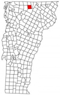
Westfield, Vermont is located in Orleans County and is considered part of the state’s “Northeast Kingdom”. This rural town has a population of 526 (2020 Census).
Chartered on May 15, 1780, Westfield was one of six towns granted as part of a fund- raising effort. Colonel William Williams of Wilmington, Vermont, among others, had served on a legislative committee that came up with the solution of selling these lands for raising funds. Only two grantees paid their granting fees on time and were chartered that May: Enosburg and Westfield. Out of several explanations for Westfield’s town name, the most plausible is that it was named after the Honorable William West, Esquire, a distinguished resident of Scituate, Rhode Island and one of several New England legislators supporting statehood for Vermont. West sold this and other lands he had been given for his political services in 1785, and there is no record of him ever visiting the area.
During the war of 1812, the inhabitants were apprehensive of a British invasion from Canada. The barn of Captain Mead Hitchcock was converted into a blockhouse refuge, but fortunately never had to be defended. Hazens Notch represents another tie to Vermont’s history. Again stimulated by concerns for British expansion into the region, the nearly 2,000 feet high “Notch” just south of Sugarloaf Mountain, is the northern terminus of the old Bayley-Hazen Military Road, which begins at Newbury in Orange County. Built by Generals Bayley and Hazen during the Revolutionary War, the military road was a possible invasion route to Canada. Less tenuous ties to the past have served to stimulate “by-ways” in other regions of the state and country.
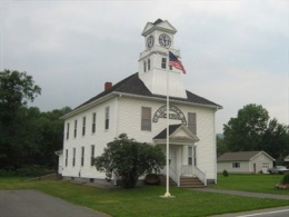
Westfield’s only post office was located in the village in 1830 when the population of the town was just over 350. The post office still serves inhabitants, numbering 503 in the 2000 Census, a 19% increase from 1990. The Westfield green is a significant common area, shaded by maple trees and located on level ground at the edge of the larger alluvial plan around Route 100. The Hitchcock Museum and Library (pictured), a square white building with a clock tower, was built in 1899, and has exhibit rooms with 19th-century farm tools, furniture, costumes, linens, photographs, rock, butterfly and coral collections.
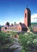
The town is also home to the Benedictine Monastery of the Immaculate Heart of Mary, founded in 1981 by the Abbaye Sainte-Marie des Deux-Montagnes in Canada. They are contemplative Benedictine nuns belonging to the Congregation of Solesmes.
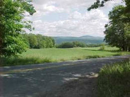
Westfield is heavily influenced by the natural resource base. Farm and forest land dominate, and the towns of Jay and Westfield share a series of peaks defining the northern most chain of the Green Mountains. The peaks immediately related to Jay Peak form a critical part of the local, regional, and even, one might suggest, the international landscape. These peaks dominate the area and are visible from town and many points throughout the Northeast Kingdom, including being part of a panoramic landscape visible from Burke Mountain, from the fire tower near Lake Elmore, from the town lookout in Brownington, as well as many areas to the west and from vantage points along the river plain formed by the St. Lawrence River in Canada. It is reported “on a clear day, one may view the streets of Montreal to the northwest, the White Mountains to the east, and Lake Champlain and the Adirondacks to the south and west,” from these peaks.
(Adapted from the UVM Center for Rural Studies)


